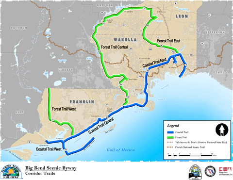
Coastal Trail East
Length: 47.3 miles. Begin: Wakulla County at intersection of Coastal Highway (US 98) and Lighthouse Road (CR 59). End: Franklin County at intersection of Coastal Highway (US 98) and Sopchoppy Highway (US 319).
View the video
Coastal Trail Central
Length: 23.2 miles. Begin: Franklin County at intersection of Coastal Highway (US 98) and Sopchoppy Highway (US 319). End: Franklin County at intersection of Coastal Highway (US 98) and SR 65.
View the video
Coastal Trail West
Length: 25.6 miles, including the spur route to St. George Island State Park. Begin: Franklin County at intersection of Coastal Highway (US 98) and SR 65. End: Franklin County ay west end of Market Street in Apalachicola.
View the video